History hidden within NOAA’s ‘Inland Water Wind Reports’
Mar 1, 2024, 3:34 PM
Though it’s not quite as iconic and beloved as the BBC Shipping Forecast in the U.K., the handful of spots along the shores of the Puget Sound, for which the National Oceanic and Atmospheric Administration (NOAA) Weather Radio often gives windspeed reports, have their own history and charm.
So far, it’s hard to tell whether March 2024 came in like a lamb or a lion, but just a few days ago, late February was here with a pretty darn lion-y windstorm. The gusts and gales created the perfect occasion to tune in to NOAA Weather Radio. The commercial-free, government weather radio channel is heard on specially dedicated radios or special bands on some kinds of AM/FM radios. In the Seattle area, that station is known officially as KHB-60 and is found at 162.55 MHz on the radio dial, or channel 7 on dedicated weather radios.
History of NOAA Weather Radio
Back in the 1970s, when NOAA Weather Radio was becoming a national system of antennas and transmitters, broadcasting local forecasts and updates on current conditions, the voices heard on-air were actual humans. Local staffers at many National Weather Service offices would record a forecast along with a list of recent temperatures and windspeeds, for a total of maybe three or four minutes worth of material. That tape would then play on a loop and be sent out over a nearby antenna until a new one was recorded (either on a regular schedule or when changing conditions warranted).
To streamline the operation and reduce costs back in the 1990s, those local stations began switching over to computer-generated voices that could convert a written script into an audio file with no live and local weather forecaster required to spend time in front of a microphone or tape recorder.
While costs may have been reduced, one price to be paid was the local forecasts lost some of their humanity and simple charm, as those local voices, of often untrained broadcasters, were literally silenced. What those human voices were replaced by was software that generated a voice – known as “Paul” – which was not unlike the voice adapted for use by the late physicist Stephen Hawking.
More from Feliks Banel: Will Everett mayor accept compromise to save Clark Park gazebo?
Fast forward to 2016, and NOAA cycled through successors to Paul (named Donna, Craig, Tom and Javier), a new and updated “Paul” came on the job, sounding much different than the original automated voice, if not quite yet fully human.
For anyone listening during Wednesday’s windstorm, the new and improved Paul would, every few minutes or so, give the current windspeed for five locations around the shores of the Puget Sound. In between, were updates on watches and warnings and updated forecasts about what was ahead.
“Inland water wind reports in knots,” the new Paul intoned.
“Smith Island, south 24. Point Wilson, south 8. Point No Point, wind calm. West Point, south 34. Point Robinson, south 24,” he continued, only rarely pausing for a digital breath.
Why does NOAA use those five specific locations?
The not-so-casual listener might wonder, “Why those five specific locations?” And then, that same listener might think, “Wait, wind calm at Point No Point? How could that be?”
That second question? Nobody knows. But it turns out the first question is easy to answer because those places all have something in common.
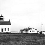
As explained by KIRO Newsradio Meteorologist Ted Buehner, those places are all long-time locations of federal government lighthouses. And all now have automated weather stations that report data back to the central forecast office. Even Smith Island, which lost its lighthouse back in the 1950s, is now part of something called the Coastal Marine Automated Network (CMAN) and has a set of instruments mounted on a tower.
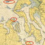
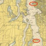
In hopes of creating a mystique around the Puget Sound’s “Inland Water Wind Reports,” that might someday match the fervor surrounding the BBC Shipping Forecast, here’s a little background and mostly non-Indigenous place-name history on each of the five sites mentioned in Paul’s reports.
Latest MyNorthwest Weather: Weather Center
Background of the locations
Smith Island is west of Whidbey Island at the east end of the Strait of Juan de Fuca and, with adjacent Minor Island, has been declared a State Aquatic Reserve off limits to the public. It’s believed to have been named for a Hudson’s Bay Company staffer named Smith, perhaps in the 1840s or 1850s. In 1841, U.S. Naval Commander Charles Wilkes, of the Wilkes Expedition, had called it Blunt’s Island for Midshipman Simon F. Blunt – but that didn’t stick. A lighthouse was first established there in 1858 and was shut down in the 1950s before eventually crumbling into the sea.
Point Wilson is at Fort Worden State Park near Port Townsend. It was named in 1792 by Captain Vancouver for his friend Captain George Wilson of the Royal Navy, who fought against our great allies the French during the American Revolutionary War.
“The Clallam Indian name for the point was Kam-kun, the Chimacum name was Kam-kam-ho,” wrote Robert Hitchman, author of “Places Names of Washington.”
The lighthouse was first built in 1879 and was rebuilt in 1913.
Point No Point is near the northern tip of the Kitsap Peninsula and is west across the water from the southern tip of Whidbey Island. It was named in 1841 by US Naval Commander Charles Wilkes, perhaps after one of ten other locations called “Point No Point,” and listed by the US Board of Geographic Names around the United States. The name here in the Northwest is said to come from the distance, the point can look more prominent than it actually is once you get closer to it.
“The Indian name was Hahd-skus, meaning long nose,” wrote Robert Hitchman.
The lighthouse at Point No Point was built in 1879.
West Point was named because it’s a point, and it’s a point that points west. See my point?
West Point is in Seattle’s Magnolia neighborhood, at the far northwest part of Discovery Park, and functions as something of a northern entrance to Elliott Bay. West Point was named in 1841, once again, by US Naval Commander Charles Wilkes because it’s a point, and it’s a point that points west. See my point? Aerial photographs, as well as nautical charts, confirm it is a very pointy point.
“The Duwamish Indian name was Oka-dz-elt-cu, meaning ‘thrust far out,'” writes Robert Hitchman. The much-photographed lighthouse was built at West Point in 1881.
More history on Washington: The thousand-year-old origins of the name ‘Washington’
Point Robinson (aka “Robinson Point” for place-name purists) is on Maury Island, which is functionally part of Vashon Island and is not far from the SeattleSports 710 transmitter and original 1941 KIRO Radio transmitter building. This spot is right across the water from Des Moines. It was named by, you guessed it, good old U.S. Naval Commander Charles Wilkes in 1841 for R.P. Robinson, purser’s steward on the USS Vincennes, the lead ship of the Wilkes Expedition. The lighthouse was built in 1885 and rebuilt in 1915.
For more information about these and other Washington place names, there are a handful of useful books, including Robert Hitchman’s “Place Names of Washington,” “Maritime Place Names: Inland Washington Waters” by Richard Blumenthal and for Indigenous place names, “sdaʔdaʔ gʷəł dibəł ləšucid ʔaciłtalbixʷ Puget Sound Geography Original Manuscript from T. T. Waterman,” prepared by Vi Hilbert and others.
And, while those non-human weather broadcasts are all fun to listen to and talk about, let’s hope a certain pair of weekly history radio segments are many years away from becoming even partially automated.
Stay in your lane, Paul.
You can hear Feliks every Wednesday and Friday morning on Seattle’s Morning News with Dave Ross and Colleen O’Brien, read more from him here, and subscribe to The Resident Historian Podcast here. If you have a story idea or a question about Northwest history, please email Feliks here.


